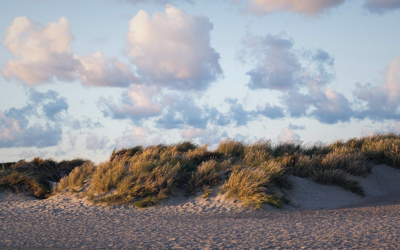
Scania's coast is not one thing. Hard rock meets soft drift in a province-spanning seam, and the switch between them is abrupt enough to stop you mid-stride.
01The Rock Coast: What Holds the North-West Together
Stand at the base of Kullaberg on a westerly day and the coast makes its character plain at once. Grey gneiss drops directly into the Öresund, sheered clean, wrinkled with fault lines and splashed white where the fetch has had time to build. The headland is not a beach destination. It is a place of ledges, of sea-pinks wedged into cracks, of peregrine pairs that quarter the face in March and oystercatchers working the kelp-draped boulders below. The rock here is among the oldest exposed material in southern Sweden — Precambrian basement that has been buckled and compressed and re-exposed by erosion until it sits as a blunt prow pointing south-west into the strait.
Moving south along the Öresund shore, the cliffs do not continue unbroken. They interrupt themselves. Sandy coves appear between headlands, small and gravelly and often east-facing, sheltered enough to hold beds of common eelgrass at their margins. But these are pockets, parentheses between the hard parts. The structural logic of this stretch is still rock: old ridges running roughly north-east to south-west, their seaward ends truncated by the water. Helsingborg sits on one of these low ridges, its castle tower built on the same elevated gneiss that shows along the shore just north of the ferry terminal. The bluffs thin out as you go south, but the underlying material — the dense, pale, resistant basement complex — stays close to the surface.
North of Helsingborg, around Skälderviken, the coast begins its first experiment in softness. The bay is shallow, its floor sandy, and along its southern arc the long beach and dune belt that backs Ängelholm has built up against what should still, by regional geology, be solid ground. This is the first major interruption: the bay has accumulated enough sediment — blown, washed, sorted by longshore drift — to lay a sand apron over the harder substrate. The transition is not yet complete. But the logic has begun to shift.
02The Seam: Where the Drift Begins to Win
Somewhere between Skälderviken and the broad south-facing shores of Hanöbukten, the coast makes a decision. Sand stops being occasional and becomes the rule. The question is where exactly the crossover happens, and the honest answer is that it moves, depending on what you measure and how recently it has been measured.
The geological explanation runs like this. The north-western coast is dominated by outcrops of the Fennoscandian basement — crystalline, resistant, elevated just enough by the Romeleåsen ridge system to stand clear of the sea. The south and south-east, by contrast, are built on younger sedimentary material: chalk, limestone and the thick blanket of glacial outwash and till deposited when the last ice retreated northward about twelve thousand years ago. That outwash is soft. The sea can lift it, move it and put it down elsewhere. Given time — and it has had twelve millennia — it does exactly that.
The result is a coast of dunes and barrier beaches, of spits and tombolos, of shingle banks that migrate a few metres in a single winter storm. The sediment does not rest. Around Sandhammaren, the south-eastern tip of Sweden, the beach extends for kilometre after kilometre of pale quartz sand, its form shifting seasonally as the winds reorient. The Sandhammaren dune system is one of the most active in northern Europe: the sand is not decoration, it is transport. It moves north-east in autumn and west in spring, and the marram grass that anchors it does so only provisionally, only where it has had a few consecutive growing seasons without major storm disturbance.
Between these two coasts — the gneiss north-west and the sand south-east — there is a zone that genuinely belongs to neither, and it runs roughly from Malmö east through Ystad and on toward Kristianstad and the river mouths of the north-east. Here the coast is low, backed by farmland that drops gently to the shore, with chalk and limestone close beneath thin soils. The beaches are mixed: sand and flint pebbles and occasional outcrops of the white chalk that appears as low cliffs in a few places between Malmö and the Falsterbo peninsula. These chalk cliffs, modest as they are, represent a third coastal character entirely — neither crystalline rock nor glacial sand — and they reward close attention. The flint nodules weathering out of them are the same material that ends up mixed into the beaches eastward, carried by the same longshore drift that shifts everything along this coast.
Here the coast is low, backed by farmland that drops gently to the shore, with chalk and limestone close beneath thin soils.
| North-west: rock | South-east: sand | |
|---|---|---|
| Substrate | Precambrian gneiss, Fennoscandian basement standing clear of the sea | Glacial outwash and till, sorted and re-sorted by longshore drift |
| Form | Ledges, cliffs, kelp-draped boulders, pocket coves between headlands | Dunes, barrier beaches, spits and shingle banks that move each winter |
| Birds | Nesting seabirds on ledges and crevices; peregrine on the face at Kullaberg | Waders, terns, wintering scoter and long-tailed duck offshore |
| Plants | Sea thrift and sea campion on rock and stabilised shingle | Sea rocket and sea sandwort, then marram, then sea buckthorn |
| Walking | The terrain sets the route; the path keeps to the cliff edge | No path needed and none given — the difficulty is orientation, not access |
03Reading the South-East Shore
The Falsterbo peninsula is the pivot. It is the point where Scania runs out of land and the Baltic and the Öresund negotiate their shared edge. Geologically it is a low spit, almost sea-level, built entirely from materials the sea has sorted and deposited. There is no rock here in the crystalline sense. The firmest ground is compressed peat and buried dune, and even that shifts its moisture content so dramatically between seasons that the vegetation cover changes from year to year. In autumn the migration spectacle overhead is a consequence of this geography: the land narrows to a point and the birds follow it, funnelled by the same coastal logic that shapes the sand.
East of Falsterbo, the coast swings through the shallow arc of Ystad's long beach, turns the corner at Sandhammaren, and then runs north-east into the quieter, calmer waters of Hanöbukten. This stretch has a different quality from the exposed south-western shore. The fetch is longer but the storms less frequent, the water less salt, the sediment finer. Where Sandhammaren faces directly south into the Baltic and takes the full weight of autumn gales, the beaches around Åhus and the mouth of the Helge å are sheltered enough that reedbeds can grow at the water's edge. The transition from open sand coast to sheltered estuary is one of the sharpest changes in the region's coastal character, compressed into forty kilometres of shore.
The Kristianstads Vattenrike biosphere reserve, which covers the Helge å floodplain and its approach to the sea, is in one sense the logical end-point of this eastern coast: a landscape shaped entirely by water movement, sediment and the slow building-up of alluvial material. The coastal influence here is tidal only in the weakest sense — the Baltic tide is negligible — but the seasonal flooding, the river-mouth bars, the sand islands and the shallow lagoons are the same processes at work as further south, just in slower, flatter form.
- About twelve thousand years agoThe last ice sheet retreats northward, leaving a thick blanket of outwash and till across the south and south-east.
- The millennia after the iceThe sea begins lifting and sorting that soft material, moving it along the shore and putting it down where the energy drops.
- Sand takes over in the south-eastBarrier beaches, spits and dune fields build out; Sandhammaren becomes one of the most active dune systems in northern Europe.
- Every winter sinceShingle banks migrate a few metres in a single storm; the sand moves north-east in autumn and back west in spring.
04What the Seam Means in Practice
The shift from rock coast to sand coast is not just a matter of scenery. It reorganises everything that uses the shore. The boulder-and-cliff sections support nesting seabirds — guillemots occasionally, razorbills, the ubiquitous herring gull and, where the slopes permit, shags — because ledges and crevices give safe nesting sites. The sand coasts cannot offer any of this. What they provide instead is the intertidal flat, the exposed sand bar at low water, the sheltered lagoon: habitats for waders, terns, wintering divers and the dense aggregations of common scoter and long-tailed duck that gather offshore in winter.
Plant communities shift just as sharply. Sea thrift and sea campion, which grow on rock and stabilised shingle, give way to sea rocket and sea sandwort on the mobile sands. Behind the active beach, where the dune builds high enough, marram gives way to sea buckthorn thicket, which gives way on the leeward side to a scrubby birch and pine zone that can look, from the inland side, like unremarkable woodland until you walk through it and smell the salt.
Allemansrätten — the right of public access that lets anyone walk on uncultivated land — applies along all of it, rock coast and sand coast alike. In practice the two types generate different experiences of that right. On the boulder shores of the north-west, the terrain limits you; there is nowhere easy to walk except the path, and the path tends to keep close to the cliff edge. On the southern sands there is no defined path because none is needed: the whole beach is navigable, the whole dune is open. The difficulty is not access, it is orientation — the same pale profile for kilometres, the same marram, the same wind. You navigate by the sun or the sound of the sea, and you accept that this coast is not one thing but several: hard and soft, ancient and newly made, fixed and perpetually in motion.
| Place | What it is |
|---|---|
| Kullaberg | hard Precambrian headland, north-west Scania; the region's rockiest coast |
| Sandhammaren | south-eastern tip of Sweden; one of northern Europe's most active dune systems |
| Falsterbo | low sandy peninsula at Scania's south-west tip; convergence point for Baltic and Öresund |
| Skälderviken | shallow north-west bay; first major sand-accumulation zone south of the rock coast |
| Kristianstads Vattenrike | UNESCO biosphere reserve; Helge å floodplain and river-mouth coast |
| Helge å | river draining north-east Scania; enters the Baltic near Åhus |
| Romeleåsen | crystalline ridge system giving structural height to the north-west coast |
| Hanöbukten | large, sheltered south-east-facing bay; calmer and finer-grained than the south coast |